While working through Trail Assistant I’ve been absorbed with the obvious next step, what if we were able to take the GPT experiment past the chat interface? It’s pretty impressive as is, but being able to overlay a track on a map, play with routes, and see the options with distances and elevation would be powerful. Also, those who know me, know I will add a map to any interface. I like maps.
So for the past couple of weeks, I've shown the tool to people, watched them use it, taken feedback, and started putting together mockups and user flows to get a feel for the idea. I ended up focusing on two use-cases representing either end of the complexity scale. One end, is simply “help me find a short day hike”, and the other end is “help me plan a multi-day backpacking trip”. Each prototype used existing mapping solutions and real data from chats with Trail Assistant to provide what is possible.
Help Me Find a Day Hike
“I don’t want to pick a single hike 10 miles from my house. I want to see a range of places that have at least “X” miles of trails within “Y” minutes of my location.”
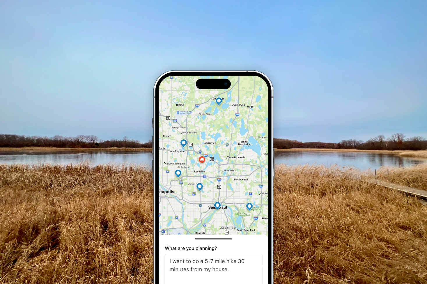
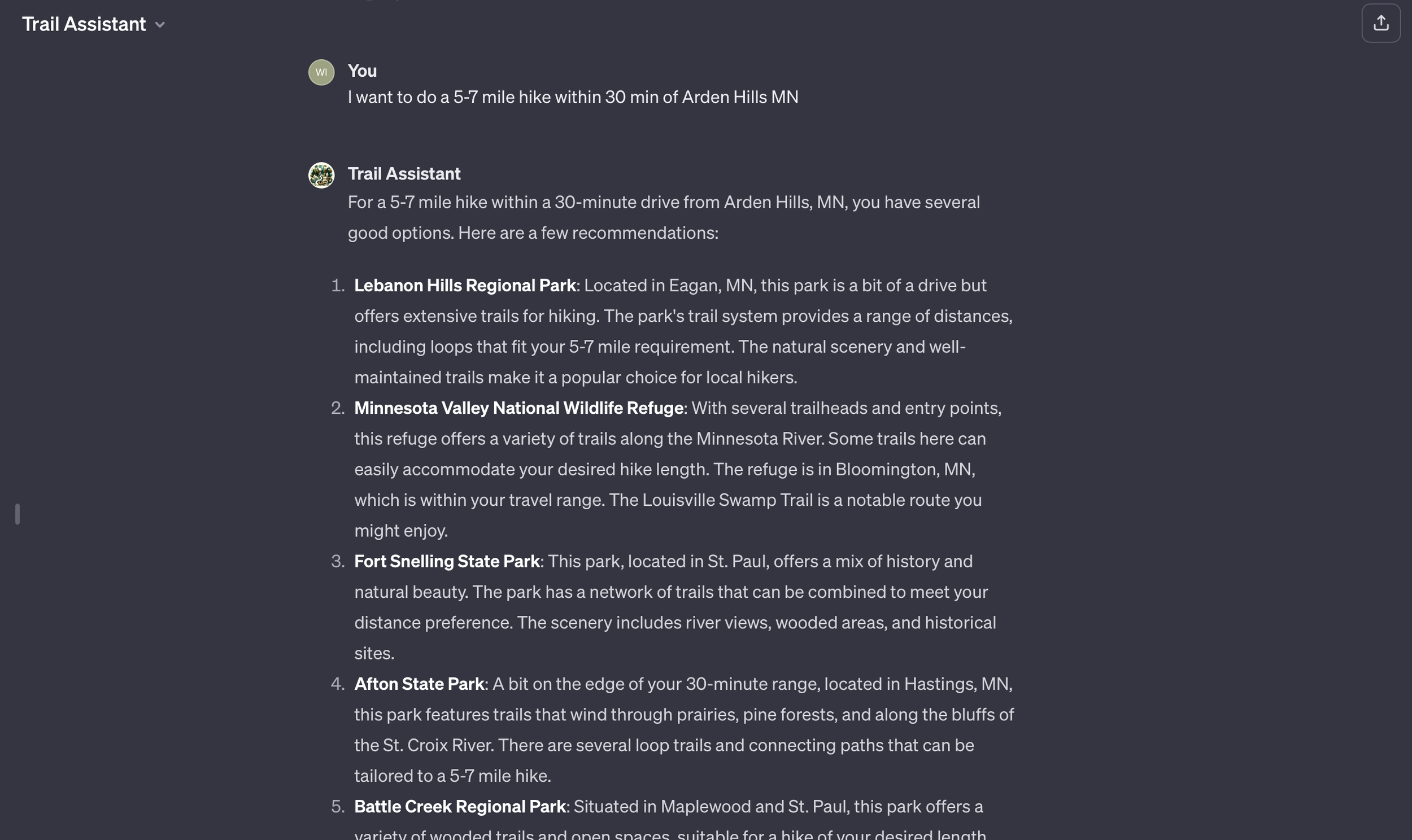
This is the simplest use-case and may seem trivial at first. I almost ignored it, but a couple of people told me they had done this, and it worked well. So I gave it a try. I quickly realized this was something I've wanted for a long time and didn't realize it. Trail Assistant was able to pull in places to go on a hike based on a desired mileage and driving time from my location. This is deceptively simple, and it highlighted something important. The current tools to find hikes answer the wrong question. I don't want to pick a single hike 10 miles from my house. I want to see a range of places that have at least “X” miles of trails within “Y” minutes of my location. This lets me pick a location based on what is there, and choose my own path.
My search brought up places to hike among state, local, and private parks, all had routes with at least the correct mileage and all were within a specified driving radius. From that one search, I was able to plan two different hikes. Another session, surfaced campsites across federal, state, local, and private campgrounds. If you've ever tried to book a campsite in Northern MN during leaf season you know how hard that is to do.
I started the prototyping with this simple use-case. I sketched out an interface that allows you to lay a marker down anywhere (in this instance at your home) and start typing. The prompt contains all the necessary information so the tool can interpret and return options. The ability to change the prompt is always available, but the speed of just typing in a prompt and being presented with options is like nothing out there today.
Help Me Plan a Multi-day Backpacking Trip
This is where I started with Trail Assistant, mostly to scratch my own itch since I am planning a long 100± mi backpacking trip this summer. I've already written about why this is a hard task , and how helpful Trail Assistant has become with this.
This is a highly simplified proof of concept. I worked with the same base as the simple use case just to see what could be done. It hits most of the high-level points, but it is missing the complexity of surfacing alternate routes, making choices, and details like alternate sites, food restock locations, etc. All that being said it is pretty successful as a proof of concept.
Next Steps
I'm not sure! This is pretty promising, and I think there's a lot more that could be done. It has the start of something that could give, AllTrails, Gaia, onX, or any number of other apps a run for their money. I will continue exploring the idea, and in the meantime, if anyone is interested in making this a thing reach out, I'd love to talk.


